Tuesday, November 30, 2010

Talk on James Fitzjames at Durning LIbrary

On Monday, 17th January, the Victorian-era splendor of the Durning Library will host a talk by William Battersby on the life and career of James Fitzjames, based on his research for his recent book James Fitzjames: Mystery Man of the Franklin Expedition. For those who may not be familiar with this remarkable venue, it's in the borough of Lambeth and readily accessible from central London; the address, for Google and GPS users is 167, Kennington Lane, London, SE11 4HF, a brief walk from the Kennington tube station on the Northern line.

Mr Battersby's talk is hosted by the Friends of the Durning Library; it begins at 7:15 p.m.; according to the description on his blog page, "The Friends will provide light refreshments and there is no admission charge, although a £2.00 donation is suggested." Among the many other aspects of this fascinating subject, Mr Battersby promises to touch on "the intriguing links between Kennington and James Fitzjames himself." It's certainly an event which I would very much want to attend, were I to be anywhere in the greater London area on that evening; for those who are unfamiliar with Mr Battersby's book on Fitzjames, I recommend it highly -- there's much within that has never been guessed at by earlier Franklin researchers.

[Photo of the Durning Library by Derek Harper]

Sunday, November 21, 2010

Franklin Curiosities: Ron Toelke

A few months ago, in one of my installments on Franklin Curiosities, I mentioned the small toy replica tins of Goldner's Patent Provisions crafted by Ron Toelke. Since then, I was very pleased to be able to get back in touch with Ron, and learn about some of his more recent artistic creations. Among the most remarkable of these, without doubt, are the portraits in his series A Sorrower on the Sea of Doubt. Based upon the famous Franklin daguerreotypes taken by Beard and his assistants in 1845, these portraits each incorporate Toelke's hand-cut portrait of the sitter on metallic paper, along with four lines from the poem, Lady Franklin's Appeal to the North, first published in the New York Times on October 18, 1851. Each portrait is framed on tombstone-shaped marbled paper, surmounted with an image of the Arctic Medal with the north star at its peak. The cover glass of each portrait is treated with a special finish that crystallizes into its own unique icy pattern. Although I have not seen one of these works in person, they're certainly among the most striking contemporary versions of the portraits of Franklin's men that I know. The collection takes its name, "Sorrower on the Sea of Doubt," from the last line of the poem.
Toelke's many other projects are no less commendable; he has another toy set, Battleships of the World, which are wonderfully crafted of wood, paper, and paint. He is also at work on a set of Arctic playing cards, which will be based in part on similar souvenir decks produced in the 1850's, with illustrations taken from the books and illustrated papers of the day. To my mind, this is just the sort of artistic endeavor which brings together the fascination with the old with a new sense of what craft and care can produce; no Franklin collection would be complete without something of his work.

Monday, October 25, 2010

"Echoes in the Ice" at Canada Science and Technology Museum

Canada's Science and Technology Museum is hosting an exhibition, "Echoes in the Ice: History, Mystery, and Frozen Corpses," which runs from now through March 20, 2011. This exhibition had its origins in a series of collages by artist and filmmaker Rik van Glintenkamp, illustrating various aspects of the search for the North Pole and the Northwest Passage. The idea was to combine these images with an array of original relics of Franklin's last expedition, educational videos, and the evidence for cannibalism. The resulting show offers an impressive array of set-pieces -- my favorite is a replica of John Hartnell's original grave-board on Beechey Island with a full-size image of his exhumed corpse -- along with a judicious selection of actual artifacts. A boot-heel, modified with nails, was once worn by one of Franklin's men, who -- never supplied for overland travel -- had to improvise their footgear and garments from materials on board their ships. Other artifacts include tins of Goldner's provisions and a barrel lid on loan from the Prince of Wales Northern Heritage Centre, along with period instruments such as sextants and maritime compasses. Texts and photos from the 1993 excavation of the site known as Ng-Lj2 were prepared with assistance from Margaret Bertulli and Anne Keenleyside, two of the lead archaeologists on that survey. Photos of skeletal remains, many of them showing the cut-marks made by men in their last, desperate moments, complete the grim picture.

As the press release describes it,
"The stories are told using images, audio-visual presentations, and artifacts. With the mandate to observe everything from “flea to whale,” the Franklin Expedition relied on the scientific and technological instruments of the day during their search for the Passage. Instruments and objects dating from the same period as the Franklin Expedition are on display, including navigation tools, and a brass-bound mahogany case containing a set of surgical instruments used for post-mortem dissections."
It's certainly an exhibit that will hold enormous interest for anyone who has been following the continuing story of our effort to understand the final days of this ill-fated expedition.

Wednesday, September 29, 2010

Arctic Box Bait-and-Switch?

News that the box unearthed from under the Gibson memorial in Gjoa Haven did not contain any Franklin records came as no surprise to those of us who have been following the story -- least of all to Kenn Harper, whose research clearly showed that all that had ever been buried there was an Amundsen record and photograph. But these, too were missing, as was the white marble slab which was supposed to have been incorporated into the monument. This puzzled us all, until I read this post on Ken McGoogan's blog, in which he recounts his conversation with Louie Kamookak, Gibson's grandson. According to this posting, the Amundsen record, as well as the marble block, had been removed from the cairn a few years after their deposit by another party of HBC employees, and had been deposited in the Yellowknife archives.

I was stunned to think this was possible, and this morning searched the online archives of the Prince of Wales Northern Heritage Centre; prior to the establishment of the territory of Nunavut in 1999, this is where all such artifacts would have been deposited). And, although I didn't find a listing for the Neumayer photo, the marble slab (or at least a photo of it) is indeed there. Its description, complete with a spelling error, makes its identity clear: "White marble plaque place by Amundsen in 1903 at Gjoa Haven. The plaque is 1/2 mile east of the settlement. Amundsen left many records under this."

That the stone could have ended up at PWNHC would not, in other circumstances, be a surprise; they have many such artifacts, including the original grave-boards of the Franklin crewmen buried at Beechey Island (the ones on Beechey are replicas with bronze nameplates). But that the Government of Nunavut, the Porter family, and a bevy of lawyers would have taken the time, the trouble, and the expense to dig up a box whose contents were not only known, but safely on deposit in a government archive, boggles the imagination. The official press release states that "despite the fact that the box did not contain the objects originally thought to be inside, this was an important project to undertake given the potential significance of these items and their importance to the local community." Well, if that makes sense, I've got some "Franklin" records buried in my back yard that I'd love to have the government help me re-landscape.

No public word yet on how or why this non-story ever got the funding and attention it did -- and my experience tells me not to hold my breath.

UPDATE: Kenn Harper has pointed out that the photo at PWNHC appears to be from the 1940's, prior to either the stone or the record having been moved to the Gibson monument -- so there's no clear confirmation as of yet whether they have either of the actual physical items.

UPDATE II: I have just had confirmation from the Prince of Wales Northern Heritage Centre that they do hold items "related" to the Gjoa Haven find -- they won't be specific, though they confirm they have "a photograph" and a "small bit" of the marble slab, saying these items are now part of the Archives of Nunavut, and under its jurisdiction.

Wednesday, September 22, 2010

Grylls' Route

After a good deal of jiggering around with the route-tracing page on Bear Grylls' site, I managed to get a close-up view of his journey as he passed by the NE corner of King William Island. As you can see in the comparison shot here, he passed almost exactly through the area I'd initially thought, nipping the NE corner of Qikiqtarjuaq Island. It would seem to me that the locality of the "uncharted" islet on which these graves and other remains were found must have been in the immediate vicinity of Cape Sabine, or else possibly near the unnamed bay to the north of Cape Edgeworth. Still no word from Mr. Grylls, but let's hope he continues uploading photos to his page here -- maybe we'll see something of what he has described on his blog.

Sunday, September 19, 2010

New Franklin Find Claimed

In a story first noted on William Battersby's blog, adventurer and television presenter "Bear" Grylls has claimed a new Franklin find off the coast of King William Island in Nunavut. The exact location of the find has not been disclosed, although it appears to be somewhere off the northeast coast of the island. In Grylls' account, on the northern side of a tiny islet they dubbed "Jonesy Island" after their engineer, they found signs of three large fires "on the side of the island abutting Wellington straight [sic]" which they surmised to be signal fires lit to attract rescuers; they also found "part of a mast" blown up on shore, whale-bone pins, stone tent circles, and "human remains buried in western looking graves."

Since their initial description is rather vague (they even describe the area as "uncharted" though that's clearly not true), I can't say for certain whether this specific site is, in fact, previously known. That Franklin survivors would burn scarce wood as a signal seems a bit farfetched, unless they actually believed a ship to be nearby, and if indeed the site dates to the Franklin era, any grave would be "western style" since Inuit of this period did not build permanent graves of any kind. The tent circles could be Inuit; an expert eye would be needed to tell, and probably a closer site survey; bone pins suggest pre-contact Inuit, and that the site was in use well before the arrival of any Europeans.

On modern charts, the description seems to match the area of the Tennent Islands, the largest of which is Qikiqtarjuaq (not to be confused with the island of the same name off Baffin Island). And there is, in fact, an Inuit account of Franklin materials from this area; the Inuk Hall knew as See-pung-er (the same who was among the first to obtain materials from near Point Victory) said that "he had also seen a monument about the height of a tall man at another point between Port Parry and Cape Sabine." Hall asked him if he had torn down this cairn, and See-pung-er answered "only enough to find something within." This something, Hall was disheartened to hear, was a tightly-sealed tin canister which was "full of such stuff as the paper on which Hall had been writing," and since it was "good for nothing to Innuits" it had been given to the children, or thrown away. See-pung-er went on to say that he and his uncle had camped near the site, wrapping themselves in blankets they found in a pile of white men's clothing; he further mentioned that a "kob-lu-na's skeleton" lay nearby.

So the new "discovery" sounds to me very much like the same site, or one closely related to that seen by Grylls and his party. It's possible that some of the surface artifacts were unrelated to Franklin's men, but the description of the graves certainly sounds telling; they also saw a small scrap of blue cloth, which could be connected to the pile of clothing, or one of the graves. The site should certainly be visited by trained archaeologists, as there has not, in modern times, been any effort to retrace Franklin men's footsteps in the northeast area of King William Island, though it is fairly clear that some of them must have fled there, or paused in their flight elsewhere.

This story has since broken into the public press, with an article in The Independent on Sunday which gives Grylls' account in a way similar to when it was first posted on his own blog; the persons consulted by the reporter seemed to feel this was new news -- but in fact, as in so many cases, it's most likely a site already visited by Inuit early on after Franklin's men perished, and documented in Hall's notebooks.

Friday, September 3, 2010

Alleged Franklin Records in Gjoa Haven

This is a guest column written by Kenn Harper at the invitation of Russell Potter.

Tomorrow Walter Porter, an Inuk in Gjoa Haven, Nunavut, promises to excavate the logbooks of the lost Franklin expedition from beneath a cairn in his community where, he says, his grandfather buried them over four decades ago. It would, of course, be a fantastic discovery and, like most, perhaps all, students of the Franklin saga, I wish his promise would be realized. But I expect that it won’t be. Here’s why.

In 1958 Eric Mitchell, a Hudson’s Bay trader, dug up records left by Amundsen in Gjoa Haven in 1905. They were, according to Mitchell’s own reminiscences, buried just under the white marble slab that Amundsen had used for his magnetic observations. Paddy Gibson, an earlier HBC trader, had previously unearthed them in 1927, looked at them, made copies, and reburied them in the same spot. Gibson wrapped the records in some old newspapers of the day, before reburying them. He mentions it in an article he wrote in 1940 (“Amundsen in King William Land,” The Beaver, Outfit 271, June 1940, 32-38).

Coincidentally, William (“Paddy”) Gibson was the grandfather of Louie Kamookak of Gjoa Haven, a researcher with a long-standing interest in the Franklin mystery and who doubts that the records that Porter will unearth have anything to do with Franklin.

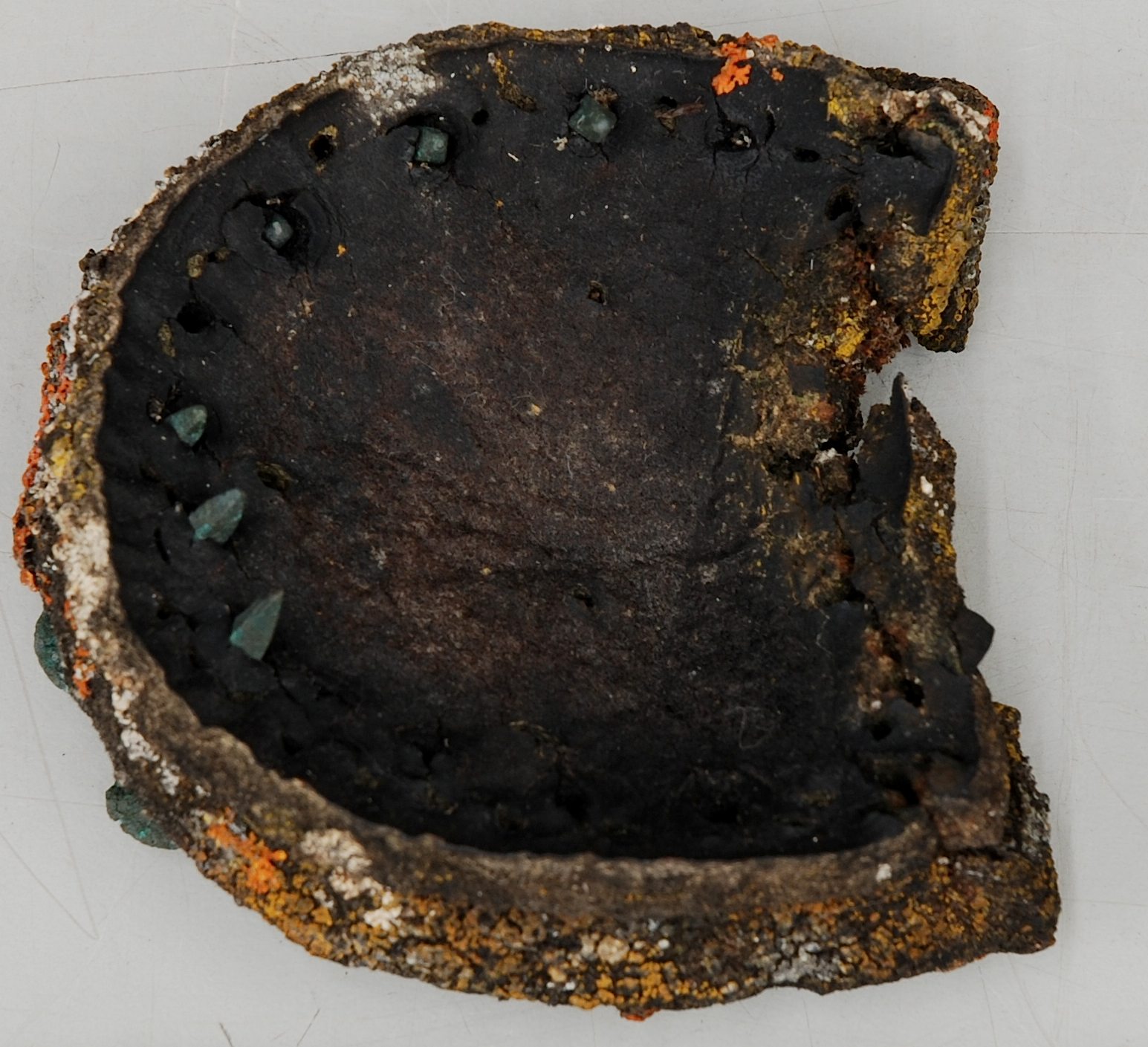
Eric Mitchell was assisted in his excavation by George Washington Porter, an Inuk. The records were in a rusty tin canister. [Gibson described it as an iron box.] Mitchell took the records out and photographed them. He remembers that the records included a photograph of Dr. Georg V. Neumayer who had taught Amundsen about magnetism. In Norwegian and English there was a message saying to report any finding of this cairn message. But there was also a record in English only, saying that the box and its contents should remain where it was found.

In fact, it seems that the focal point of what Mitchell and Porter found was the photograph of Neumayer and that the rest of the contents of the metal container comprised the message that Amundsen had originally left. In 1940 Paddy Gibson wrote, “In a few moments the iron box was unearthed, and later the photograph carefully removed and exposed to view. It was an old-fashioned photograph of a dignified old gentleman with long silvery locks, bearing the following endorsement in English: ‘With best wishes for success exploring the North Magnetic Pole. To my friend Roald Amundsen, Thursday, 3rd Febr’y, 1902. Georg V. Neumayer.’ On the back of the photograph Captain Amundsen had written in Norwegian the following (the translation is from his own narrative): ‘In deep gratitude and respectful remembrance I deposit this photograph on Neumayer Peninsula. Gjoa Expedition, 8 August 1905. Roald Amundsen.’ A footnote in English requested the finder to leave the box on the spot.”

Mitchell’s reminiscences continued. Paddy Gibson died in a plane crash near Coppermine in 1942. The HBC determined to erect a monument to him in Gjoa Haven. They eventually sent up a plaque that they wanted put on a cairn. The plaque had apparently been in Gjoa Haven for some years but the cairn never erected, perhaps because there was no white man in charge of the post at Gjoa Haven. Mitchell was posted at Spence Bay. Gjoa Haven was run by George Washington Porter, an Inuk, as an outpost of Spence Bay and under Mitchell’s direction. The HBC sent Mitchell a rough plan of what they wanted the cairn to look like.

In the winter – I don’t know which winter - Mitchell travelled by dog sled from Spence Bay to Gjoa Haven and called in at the DEW-Line site at Mount Matheson to get cement for the cairn. But, because it was winter, no cairn could be built at that time. So Mitchell entrusted the instructions for the cairn and the cement and the plaque to Porter, with instructions to build the cairn in the coming summer, and rebury the record that he and Porter had earlier dug up. Mitchell told Porter to make the marble slab under which he and Porter had found the records an integral part of the cairn.

Before Mitchell left, he and Porter put the records in an envelope, then wrapped it in two pages of the Nautical Almanac for that day (the day that winter when they prepared the records for the subsequent burial by Porter). Eric had the Nautical Almanac because he was an avid student of navigation. They also wrapped them in an Edmonton newspaper. Then they took the package to Porter’s wife, Martha, and got her to sew the lot in "rubberized cloth." [Walter Porter, in the recent news report, calls this wax-treated canvas.] Then Eric put it all back in the canister or metal box. They got a wooden ammunition box (the kind of box that HBC shipped ammunition in) and filled half that box with tallow and then placed the cannister in that tallow "bed" in the box, then filled the remainder of the box with tallow, thereby enclosing the cannister in tallow before putting on the wooden lid.

Mitchell left all this with Porter. That summer Porter built the cairn. Mitchell was not there when the cairn was built so he is uncertain as to whether the records were buried and then the cairn built on top of them, or if the records are an integral part of the cairn. But he is certain that Porter, as a loyal HBC employee, followed his instructions and conducted the burial. (To anyone familiar with the company and its relationship with native employees of the time, anything else would be unthinkable.)

All of this is consistent with the elements of Walter Porter’s story - the burial of the records without any white man present. One can imagine George Washington Porter perhaps gathering a few family members together as he prepared to conduct this important task of burying the records that had been entrusted to him by Eric. I don't know how much Porter knew of Amundsen and Franklin, but probably the younger generation who were his helpers and witnesses for this solemn and important task had little understanding of whose records they were. They would have known only that they were important and that the task that Porter had been asked to perform was an important one. Over the years, as the search for Franklin's records and ships became an important subject in Gjoa Haven, this story took on a life of its own. Amundsen becomes Franklin. Or more simply, the buried papers become Franklin's papers.

Walter Porter also refers to a role played by the Roman Catholic priest, Father Henry. He claims that Father Henry had somehow acquired the records and given them to his grandfather. I don't know where Father Henry fits into this, nor can I explain the part about the Inuk who allegedly gave the records to the priest. Perhaps that is complete fiction. It wouldn't be the first time that Inuit embellished a story with fiction after the fact, and then ended up believing it. By the way, George Washington Porter, according to Mitchell, was Catholic; his wife Martha was Anglican.

I expect that when the alleged Franklin records are unearthed tomorrow, they will prove to be what Mitchell and Porter unearthed in 1958. They should contain a photograph of Neumayer, the focus of Amundsen’s original deposit. They may contain some ancillary papers. And they should be found inside a metal canister or box, wrapped as Mitchell described, embedded in tallow in an old ammunition case.

If, on the other hand, they turn out to be Franklin records, then I will be surprised but I will also be as happy as Walter Porter.

Thursday, September 2, 2010

Buried Franklin Records to be Uncovered?

Here's a curious story, which I've known about for over a year, and is finally going public: in the midst of the Inuit hamlet of Gjoa Haven, under a memorial to "Paddy" Gibson, some believe there is a cache which contains lost records of the Franklin Expedition, perhaps even Franklin's diary itself! So now at last I am free to speak of it.

Gjoa resident Walter Porter, whose grandfather helped bury the records, is convinced that they are Franklin's. His own father kept the fact secret until not long before his death, when he confided in his son the details of the burial of the records. The news story today at canada.com says that the cache is to be opened on Saturday, September 4th, so Franklin buffs the world 'round will not have long to wait!

But I myself do not believe these are likely to be Franklin records. For one, had any records of Franklin's been found by Paddy Gibson, he would likely have done what the Porter family hopes to do now: announce the news to the world, and receive the public interest and gratitude such a revelation would almost certainly elicit. No, I believe these are much more likely records of Amundsen's, who was known to have left several chaches in the area, one of which was found by Gibson, buried by him and then uncovered and reburied in the 1950s under the Gibson memorial. Nevertheless, whichever they are, there will of course be considerable historical interest in their recovery, and rightly so.

Having talked very extensively with Walter Porter, I know that, although he is anxious to have these records uncovered, he emphasizes that his interest is not in personal fame, but in bringing attention to the community of Gjoa Haven, and the situation of the Inuit in general. He repeatedly expressed to me his hope that this discovery would benefit the hamlet of Gjoa Haven, perhaps by drawing additional tourists, perhaps through the establishment of some kind of permanent museum. In a town where more than 1,000 mostly young residents must find their way through life when there are only a couple of dozen year-round jobs, it's an understandable desire. At the same time, though the agreement mentioned in the Canada.com article specifies that the documents be returned to Gjoa Haven, it also appears to stipulate that they remain the property of the Porter family -- this seems quite a remarkable agreement, as any records found would seem to be more fittingly regarded as national property.

Curiously, the legal correspondence about this excavation -- some of which I have seen -- was prepared by an Inuk lawyer whose name is Lillian Aglukark. Her surname, as fate would have it, is the same Inuktitut name which the Inuit used to refer to the mysterious last leader of the Franklin survivors -- a name which Charles Francis Hall spelled as "Aglooka."

There is only one way to find out what really lies beneath these stones -- and on Saturday, though I am doubtful, there is no one who would be more surprised and delighted were these to turn out to be some of the long-lost records of the final Arctic expedition of Sir John Franklin.

[photo courtesy of Walter Porter]

Monday, August 30, 2010

No Franklin ships this year

As the Canadian Press put it in their article today, "Arctic Ship Searchers Come Up Cold this year." It's not the news we had all hoped to hear, but it's not entirely discouraging either. I have always felt that a large part of the difficulty in finding traces of Franklin's ships is that the area is, simply put, too vast to be searched without a significant, concerted effort over a period of time. Compared to the total area in which the ships may possibly be found, only a tiny percentage has ever before been systematically searched; by adding (by all accounts) a significant area to that total, this years's expedition increased the likelihood of success next year. According to the article, the team searched "150 square kilometres of sea floor under the waters near O'Reilly Island on the east side of Queen Maud Gulf." Some of this area, of course, had already been covered by Dave Woodman's earlier magnetometer searches, although that search may possibly have missed non-metallic targets, so in any case the news represents a meaningful step forward. I hold out great hope for next year's survey, and that the Canadian government and Parks Canada will redouble their efforts - and that they may find at least some trace of one of those long-lost vessels.

Friday, August 27, 2010

New Franklin Drama

The history of Sir John Franklin on stage and screen is a lengthy one, and goes all the way back to Wilkie Collins and Charles Dickens's stage-play, The Frozen Deep, in 1857. I now hear that there's to be a new, more experimentally-minded Franklin drama put on in Chicago at The Building Stage. Entitled "The Franklin Expidition" (not sure whether this is a typographical error or a sign of the pernicious influence of Inglourious Basterds) it's billed as a "completely unique original production," one which "rather than telling the story of any single expedition ... uses the character of Franklin to get at the heart of exploring, embracing the risk of vulnerability and the unknown, and the universal challenge of connecting our everyday actions with our deepest desires." Well, I'm not sure what exactly this means, but I'm certain it will be worth seeing if you live in or near the Chicago area. I'll keep everyone updated as more details on the production emerge; tickets go on sale September 1st.

Wednesday, August 25, 2010

The Track of CCGS Laurier

[UPDATED AUG 29] As noted in a response to an earlier post, the CCGS Laurier's online track shows a route rather different than expected (thanks again to Dave Woodman for alerting me to this possibility). Using sailwx.info, one can get almost hourly updates on the vessel's current location, which shows that, rather than remaining in Queen Maud gulf, it ascended the eastern coast of King William Island as far as Matty Island. Some have inferred from this that the searchers are following up on latter-day Inuit accounts, collected by Dorothy Eber, of one of Franklin's ships being in this area, but although that's possible, I'm not sure how much we can infer from this ship's tracking data. For one, the searchers have the use of two launches, the Gannet and the Kinglett, which could enable them to conduct surveys independently of the Laurier. For two, the Laurier, a multi-purpose vessel with many tasks, may well be moving in response to other needs and obligations -- servicing navigational beacons, search and rescue, and so forth.

The August 19th update from Parks Canada is consistent with this; it indicates that
With the two Canadian Hydrographic survey launches, Gannet and Kinglett readied prior to arrival, the marine search began immediately with a side-scan sonar deployed from each launch. The side-scan sonar is towed from the stern of the launch vessel, offering an acoustic image of the sea floor. During surveys with the side-scan sonar, our team will systematically cover as much of the targeted area as possible.
It's a little frustrating that the update doesn't mention the exact location of the "targeted area," but it's clear that it's in Queen Maud Gulf, as they mention consulting ice charts of that area. I'm relieved to learn that this is indeed the area of their work, and that they're focusing on covering as wide of an area as possible in the available time; I'm certain that's the right approach. After all, readers will recall that, in the search for RMS Titanic, Bob Ballard's team and a rival French outfit were trolling the ocean back and forth in just such a manner; thanks to good luck (and perhaps some historical tips, or intuition), Ballard was the first to locate her.

As of August 29th, the Laurier seems to be retracing its route, which -- if indeed the launches did manage some means of operating independently -- could mean that it is returning to pick them up. Only time will tell.